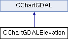
GDAL-based (elevation) chart. More...
#include <charts/CChartGDALElevation.hpp>
Public Member Functions | |
| CChartGDALElevation (const QString &_rqsFileName) | |
| virtual | ~CChartGDALElevation () |
| CDataPosition | toGeoPosition (const QPointF &_rqPointFDatPosition) const |
| double | getElevation (const QPointF &_rqPointFDatPosition) const |
| Returns the elevation at the given chart pixel position. More... | |
| double | getElevation (const CDataPosition &_roGeoPosition) const |
| Returns the elevation at the given geographical position. More... | |
 Public Member Functions inherited from CChartGDAL | |
| QVCT::EStatus | getStatus () const |
| Returns the chart internal status (after constructing object) More... | |
| QString | getFileName () const |
| Returns the chart (GDAL dataset) file name. More... | |
| QRect | getDatGeometry () const |
| Returns the chart (GDAL dataset) geometry (size) More... | |
| EColorEncoding | getColorEncoding () const |
| Returns the chart (GDAL dataset) color encoding. More... | |
| QPointF | getDatPosition () const |
| Returns the last drawn chart (GDAL dataset) center pixel position. More... | |
| double | getZoom () const |
| Returns the last drawn chart (GDAL dataset) zoom factor. More... | |
| CDataPosition | toGeoPosition (const QPointF &_rqPointFDatPosition) const |
| Converts the given chart pixel position to geographical position. More... | |
| QPointF | toDatPosition (const CDataPosition &_roGeoPosition) const |
| Converts the given (geographical) position [long,lat,elev] to chart (GDAL dataset) point [px]. More... | |
| double | getResolution (const QPointF &_rqPointFDatPosition) const |
| Returns the resolution at given chart (GDAL dataset) point [px], in meters per pixel [m/px]. More... | |
| void | draw (QPainter *_pqPainter, const QPointF &_rqPointFDatPosition, double _fdZoom) |
| Draws chart, centered on given chart (GDAL dataset) point [px] and zoomed according to given factor. More... | |
| void | move (const QPointF &_rqPointFDatPosition, double _fdZoom) |
| Moves the chart, centered on given chart (GDAL dataset) point [px] and zoomed according to given factor. More... | |
Protected Member Functions | |
| virtual void | rasterBuffer (QImage *_pqImage, const QVector< quint16 > &_rqVector) const |
| Rasterizes UInt16 buffer. More... | |
| virtual void | rasterBuffer (QImage *_pqImage, const QVector< qint16 > &_rqVector) const |
| Rasterizes Int16 buffer. More... | |
| virtual void | rasterBuffer (QImage *_pqImage, const QVector< quint32 > &_rqVector) const |
| Rasterizes UInt32 buffer. More... | |
| virtual void | rasterBuffer (QImage *_pqImage, const QVector< qint32 > &_rqVector) const |
| Rasterizes Int32 buffer. More... | |
| virtual void | rasterBuffer (QImage *_pqImage, const QVector< float > &_rqVector) const |
| Rasterizes Float32 buffer. More... | |
| virtual void | rasterBuffer (QImage *_pqImage, const QVector< double > &_rqVector) const |
| Rasterizes Float64 buffer. More... | |
| Protected Member Functions inherited from CChartGDAL | |
| CChartGDAL () | |
| virtual | ~CChartGDAL () |
| void | open (const QString &_rqsFileName) |
| Opens the underlying GDAL dataset. More... | |
Private Member Functions | |
| uchar | rasterValue (double _fdValue) const |
| double | interpolateValue (double _fdP11, double _fdP21, double _fdP12, double _fdP22, double _fdX, double _fdY) const |
Additional Inherited Members | |
| Public Types inherited from CChartGDAL | |
| enum | EColorEncoding { GRAY , GRAY_U16 , GRAY_S16 , GRAY_U32 , GRAY_S32 , GRAY_F32 , GRAY_F64 , PALETTE_GRAY , PALETTE_RGB , PALETTE_CMYK , PALETTE_HSL , ARGB , RGB , YUV } |
| Underlying GDAL dataset color encoding IDs. More... | |
| Protected Attributes inherited from CChartGDAL | |
| QVCT::EStatus | eStatus |
| Chart internal status. More... | |
| QString | qsFileName |
| Chart (GDAL dataset) file name. More... | |
| QRect | qRectGeometry |
| Chart (GDAL dataset) geometry (size) More... | |
| EColorEncoding | eColorEncoding |
| Chart (GDAL dataset) color encoding. More... | |
| QPointF | qPointFDatPositionWished |
| Last drawn chart (GDAL dataset) center pixel position (requested by user) More... | |
| QPointF | qPointFDatPositionActual |
| Last drawn chart (GDAL dataset) center pixel position (actually rendered) More... | |
| double | fdZoomWished |
| Last drawn chart (GDAL dataset) zoom factor (requested by user) More... | |
| double | fdZoomActual |
| Last drawn chart (GDAL dataset) zoom factor (actually rendered) More... | |
| GDALDataset * | poGDALDataset |
| Underlying GDAL dataset. More... | |
| void * | pGDALProjectionTransformer |
| Underlying GDAL dataset projection transformer (to internal WGS84) More... | |
| int * | piGDALBandMap |
| Underlying GDAL dataset band mapping (for ARGB/RGB/YUV color encodings) More... | |
| QPixmap | qPixmapBuffer |
| Pixmap buffer where the chart (GDAL dataset) is rendered (rasterized) More... | |
| QVector< QRgb > | qColorTable |
| Color table (for GRAY/PALETTE_* color encodings) More... | |
Detailed Description
GDAL-based (elevation) chart.
This class wraps a GDAL dataset to be used as data-elevation-model (DEM) or rasterized as an elevation chart in QVCT.
All scalar types (UInt16 ... Float64) Gray color encodings are supported.
Definition at line 47 of file CChartGDALElevation.hpp.
Constructor & Destructor Documentation
◆ CChartGDALElevation()
| CChartGDALElevation::CChartGDALElevation | ( | const QString & | _rqsFileName | ) |
Definition at line 35 of file CChartGDALElevation.cpp.
◆ ~CChartGDALElevation()
|
virtual |
Definition at line 67 of file CChartGDALElevation.cpp.
Member Function Documentation
◆ toGeoPosition()
| CDataPosition CChartGDALElevation::toGeoPosition | ( | const QPointF & | _rqPointFDatPosition | ) | const |
Definition at line 75 of file CChartGDALElevation.cpp.
◆ rasterBuffer() [1/6]
|
protectedvirtual |
Rasterizes UInt16 buffer.
Reimplemented from CChartGDAL.
Definition at line 87 of file CChartGDALElevation.cpp.
◆ rasterBuffer() [2/6]
|
protectedvirtual |
Rasterizes Int16 buffer.
Reimplemented from CChartGDAL.
Definition at line 96 of file CChartGDALElevation.cpp.
◆ rasterBuffer() [3/6]
|
protectedvirtual |
Rasterizes UInt32 buffer.
Reimplemented from CChartGDAL.
Definition at line 105 of file CChartGDALElevation.cpp.
◆ rasterBuffer() [4/6]
|
protectedvirtual |
Rasterizes Int32 buffer.
Reimplemented from CChartGDAL.
Definition at line 114 of file CChartGDALElevation.cpp.
◆ rasterBuffer() [5/6]
|
protectedvirtual |
Rasterizes Float32 buffer.
Reimplemented from CChartGDAL.
Definition at line 123 of file CChartGDALElevation.cpp.
◆ rasterBuffer() [6/6]
|
protectedvirtual |
Rasterizes Float64 buffer.
Reimplemented from CChartGDAL.
Definition at line 132 of file CChartGDALElevation.cpp.
◆ getElevation() [1/2]
| double CChartGDALElevation::getElevation | ( | const QPointF & | _rqPointFDatPosition | ) | const |
Returns the elevation at the given chart pixel position.
Definition at line 150 of file CChartGDALElevation.cpp.
◆ getElevation() [2/2]
| double CChartGDALElevation::getElevation | ( | const CDataPosition & | _roGeoPosition | ) | const |
Returns the elevation at the given geographical position.
Definition at line 287 of file CChartGDALElevation.cpp.
◆ rasterValue()
|
private |
Definition at line 292 of file CChartGDALElevation.cpp.
◆ interpolateValue()
|
private |
Definition at line 300 of file CChartGDALElevation.cpp.
The documentation for this class was generated from the following files:
- charts/CChartGDALElevation.hpp
- charts/CChartGDALElevation.cpp